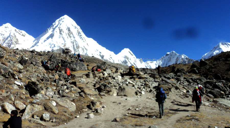
There's a moment on the trail above Namche Bazaar when the forest thins out, the air turns noticeably harder to pull into your lungs, and the first unmistakable pyramid of Everest appears between two closer ridgelines. That moment is Sagarmatha National Park doing what it does better than almost anywhere else on Earth: reminding you that you're walking through the highest protected wilderness on the planet, one that happens to also be a living Sherpa homeland.
Hand-picked itineraries
Recommended Trips
Related journeys you may want to explore after reading this article.
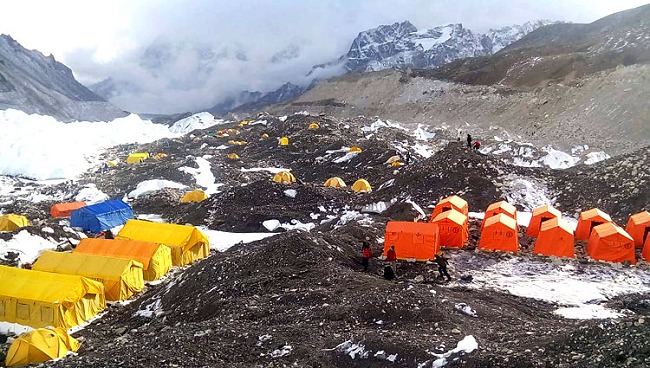
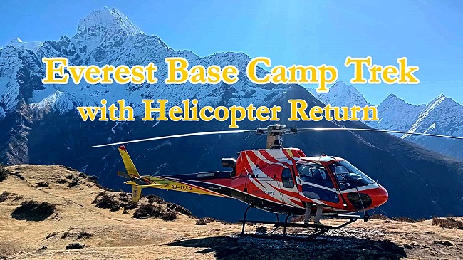

Named for Everest's Nepali name, Sagarmatha National Park isn't just the mountain everyone's heard of - it's a 1,148-square-kilometer stretch of glaciers, forests, and alpine meadows that holds three of the world's ten highest peaks, rare snow leopards and red pandas, and roughly 2,500 Sherpa residents who've shaped this landscape as much as the landscape has shaped them. Here's everything worth knowing before you go.
Quick Facts: Sagarmatha National Park at a Glance
| Detail | Information |
|---|---|
| Location | Solukhumbu District, Koshi Province, eastern Nepal |
| Established | 19 July 1976 |
| UNESCO World Heritage Site since | 1979 (Nepal's first natural World Heritage inscription) |
| Area | 1,148 sq km (443 sq mi), plus a 275 sq km buffer zone |
| Elevation range | 2,845 m (Monjo/Jorsalle) to 8,848 m (Everest summit) |
| Highest peaks inside the park | Everest (8,848 m), Lhotse (8,516 m), Cho Oyu (8,201 m), plus Nuptse, Ama Dablam, Thamserku |
| Resident population | Around 2,500 Sherpa people across roughly 20 villages |
| Key wildlife | Snow leopard, red panda, Himalayan tahr, musk deer, Himalayan black bear |
| Bird species recorded | Around 200, including the Impeyan pheasant (Nepal's national bird) |
| Entry permit (foreign nationals) | NPR 3,000 |
| Gateway | Lukla (by air) or a multi-day trek in via Jiri/Salleri |
| Best time to visit | March–May and September–November |
Where Sagarmatha National Park Sits and Why It Was Created
Sagarmatha National Park occupies the upper catchment of the Dudh Kosi River system in Solukhumbu District, in Nepal's far east. Its northern boundary runs along the main divide of the Great Himalayan Range — which is also the international border with the Tibet Autonomous Region of China — while it meets Makalu Barun National Park to the east and stretches south to the Dudh Kosi river. Together with the neighboring Qomolangma National Nature Preserve across the border, it forms a connected stretch of protected high-Himalayan landscape.
The park was gazetted in 1976 specifically to protect this fragile mountain ecosystem and the cultural heritage of the Sherpa communities living within it, and by 1979 it had become Nepal's first natural site inscribed on the UNESCO World Heritage List. A 275-square-kilometer buffer zone was added in 2002, with a revenue-sharing model that returns roughly half of buffer zone income to local user groups, tying conservation directly to community benefit rather than treating the two as separate goals.
What makes Sagarmatha unusual among the world's national parks isn't only its scenery — it's that virtually the entire park sits above 3,000 meters, making it the highest-elevation national park on Earth. That single fact shapes almost everything else about the place: what grows here, what lives here, and how visitors need to prepare before entering it.
The Mountains: More Than Just Everest
Everest, known locally as Sagarmatha ("Forehead in the Sky" or "Head of the Sky" in Nepali) and as Chomolungma ("Goddess Mother of the World") in Tibetan, is unavoidably the park's headline feature. But the park protects seven additional peaks above 7,000 meters, and its skyline reads like a roll call of legendary Himalayan summits:
- Lhotse (8,516 m) — the world's fourth-highest peak, sharing the South Col with Everest
- Cho Oyu (8,201 m) — the sixth-highest peak on Earth, near the Tibet border
- Nuptse (7,861 m) — Everest's dramatic southern neighbor
- Ama Dablam (6,812 m) — widely considered one of the most beautiful mountains in the world, its silhouette a fixture of Khumbu trekking photos
- Thamserku (6,623 m) — a striking peak visible from much of the lower Khumbu trail
Everest itself was named in 1865 for Sir George Everest, the British surveyor-general who led the Great Trigonometric Survey, though the mountain had been known locally as Sagarmatha and Chomolungma for far longer. Tenzing Norgay and Edmund Hillary made the first confirmed ascent in 1953, and the mountain's south side, accessed through this park, remains the standard route for the majority of modern Everest expeditions.
Flora and Fauna: A Vertical World of Ecosystems
Because Sagarmatha's elevation spans nearly 6,000 meters from its lowest to highest point, the park compresses an extraordinary range of ecosystems into a relatively small area - something first-time visitors often underestimate, expecting only rock and ice.
Vegetation by elevation:
- Below 3,500 m: Pine, hemlock, and fir forests dominate, with rhododendron forests bursting into red, pink, and white bloom each spring.
- 3,500–5,000 m: Birch, juniper, and dwarf rhododendron give way to alpine scrub, grasses, and meadow herbs.
- Above 5,000 m: Only the hardiest mosses, lichens, and cushion plants survive the thin air and cold.
More than 1,000 floral species have been recorded across the park in total.
Wildlife:
- Snow leopard — the park's most iconic and elusive predator, found at elevations above roughly 3,500 m
- Red panda — a rare, bamboo-feeding species found in the temperate forest zones
- Himalayan tahr and musk deer — the more commonly sighted ungulates on the higher trails
- Himalayan black bear — present in the forested lower elevations
- Indian leopard — occupying the lower-elevation forests, distinct from its snow leopard cousin higher up
Birdlife: Sagarmatha is recognized as an Important Bird Area, with around 200 species recorded, including the Impeyan pheasant (danphe), Nepal's national bird, along with blood pheasants, snowcocks, bearded vultures, and alpine choughs — enough diversity that serious birders build entire itineraries around the park.
The Sherpa Homeland
Unlike many national parks designed around removing human presence, Sagarmatha has combined nature and culture since its founding, with roughly 2,500 Sherpa residents living across about 20 villages inside the park boundaries. The Sherpa people, renowned worldwide for their high-altitude endurance and mountaineering expertise, have shaped this landscape for centuries through customs that double as informal conservation practice — restrictions on hunting certain animals and a broader cultural reverence for the surrounding wildlife among them.
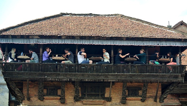
Namche Bazaar functions as the unofficial capital of the Khumbu and the main gateway hub for trekkers, with a lively Saturday market, guesthouses, cafés, and gear shops built into its terraced, horseshoe-shaped hillside. Other key Sherpa settlements along the main trekking routes include Phakding, Khumjung, Thame, Tengboche, and Pheriche, each offering a different slice of Khumbu life alongside its role as a trekker waypoint.
Tengboche Monastery, perched at around 3,860 m with a sweeping view of Ama Dablam, is the spiritual heart of the region — the largest gompa in the Khumbu and a working monastery that welcomes visitors to observe its prayer ceremonies.
Top Highlights Inside the Park
- Everest Base Camp (5,364 m) - the ultimate pilgrimage point for most visitors, marked by prayer flags and a jumble of glacial boulders at the foot of the Khumbu Icefall.
- Kala Patthar (5,545 m) - a rocky viewpoint above Gorak Shep offering the single best close-range panorama of Everest's south face, without requiring any technical climbing.
- Gokyo Lakes - a chain of six glacial lakes between roughly 4,700–5,000 m, with Thonak Cho the largest and Gokyo Cho the most visited; a serene, less-crowded alternative to the main Base Camp trail.
- Ngozumpa Glacier - Nepal's largest glacier, running alongside the Gokyo valley and a visible, sobering marker of the region's glacial retreat.
- Namche Bazaar - the trekking hub and cultural gateway of the Khumbu.
- Tengboche Monastery - the region's most important Buddhist site and a essential acclimatization stop on the main trail.
Trekking Routes Through Sagarmatha National Park
- Everest Base Camp Trek - the park's signature route, typically 12–14 days round trip from Lukla, passing through Namche, Tengboche, Dingboche, and Lobuche before reaching Base Camp and Kala Patthar.
- Gokyo Lakes Trek - a quieter alternative that trades Base Camp's glacial rubble for turquoise alpine lakes and, often, a climb of Gokyo Ri for an Everest panorama with far fewer crowds.
- Three Passes Trek - the park's most demanding classic route, linking Kongma La, Cho La, and Renjo La passes into a single loop that combines the highlights of both the Base Camp and Gokyo routes for experienced high-altitude trekkers.
- Everest View Trek - a shorter, lower-altitude option for travelers with limited time or less trekking experience, reaching Namche and the Everest View Hotel area without pushing to Base Camp altitudes.
Permits and Entry Requirements
Every visitor entering Sagarmatha National Park needs a valid entry permit, and independent trekkers should also check current requirements for the local Khumbu Pasang Lhamu Rural Municipality entry permit, which has in recent years supplemented the national park fee.
Sagarmatha National Park entry permit fees:
- Foreign nationals: NPR 3,000
- SAARC nationals: NPR 1,500
- Nepali citizens: NPR 100
Permits must be paid in Nepali Rupees and require a valid passport at the entry checkpoint (typically at Monjo). Rules and fees can shift, so confirm current requirements with your trekking agency or Nepal's Department of National Parks and Wildlife Conservation before departure. Most organized trekking operators handle permit arrangements as part of their packages, which is generally the simplest route for first-time visitors.
Getting There
There's no road access into Sagarmatha National Park — none at all — so visitors reach it in one of two ways:
- Fly to Lukla (Tenzing-Hillary Airport), either directly from Kathmandu or via Ramechhap (Manthali) during peak season, then trek roughly 2–3 hours to the Monjo entry checkpoint at the park boundary.
- Trek in overland via Jiri or Salleri, a traditional multi-day approach (7–10 days) that follows the original route used before Lukla's airstrip existed — a serious undertaking chosen today mostly by trekkers wanting a slower, less-crowded approach to the Khumbu.
Best Time to Visit
- Spring (March–May): Rhododendrons bloom across the lower elevations, skies are generally clear, and temperatures are comfortable for trekking — one of the two peak seasons.
- Autumn (September–November): The most popular window overall, with the clearest mountain visibility and stable weather following the monsoon.
- Winter (December–February): Cold, often snow-covered at higher elevations, but with clear skies and far fewer crowds for well-prepared trekkers.
- Monsoon (June–August): Best avoided for trekking — heavy rainfall, leeches at lower elevations, and clouded mountain views make this the least reliable season, though it's when alpine wildflowers are at their most colorful.
Conservation Challenges and Climate Change
Sagarmatha National Park sits at the front line of Himalayan climate change. As the source of the Dudh Kosi watershed and a major glacial freshwater supply for communities downstream, the park's glaciers - including the retreating Ngozumpa Glacier - are actively monitored as indicators of broader climate trends. Rising visitor numbers have added pressure too: annual visitation grew from roughly 3,600 in 1979 to over 25,000 by 2010, a boom that has meaningfully improved local infrastructure, healthcare, and education, but has also increased the strain on trails, waste management, and fragile alpine ecosystems. The park's buffer zone program and community-based management model are the primary tools being used to balance that growth with long-term conservation.
Frequently Asked Questions About Sagarmatha National Park
What is Sagarmatha National Park famous for? It's best known as the home of Mount Everest and seven other peaks above 7,000 meters, along with rare wildlife like the snow leopard and red panda, and the living culture of the Sherpa people who inhabit the park.
How do I get a permit for Sagarmatha National Park? Foreign nationals pay NPR 3,000 for the national park entry permit, available at the Monjo checkpoint or in advance through the Nepal Tourism Board in Kathmandu. A valid passport is required, and most trekking agencies arrange this as part of a package.
Is Sagarmatha National Park the same as the Everest Base Camp trek? Not exactly — the park is the protected area itself, and the Everest Base Camp trek is one of several trekking routes that pass through it, alongside the Gokyo Lakes trek and the Three Passes trek.
What animals live in Sagarmatha National Park? Notable species include the snow leopard, red panda, Himalayan tahr, musk deer, and Himalayan black bear, along with around 200 recorded bird species including the Impeyan pheasant, Nepal's national bird.
What is the best time to visit Sagarmatha National Park? March to May and September to November offer the clearest skies and most stable trekking conditions. Monsoon season (June–August) is best avoided due to rain and obscured mountain views.
How do you get to Sagarmatha National Park? Most visitors fly to Lukla and trek roughly 2–3 hours to the park's Monjo entry checkpoint. There's no road access, though a traditional multi-day overland trek via Jiri or Salleri remains an option for those wanting the classic overland approach.
Do people actually live inside Sagarmatha National Park? Yes — around 2,500 Sherpa residents live across roughly 20 villages within the park, making it one of the relatively few national parks in the world built around an existing resident community rather than around excluding one.
Final Thoughts
Sagarmatha National Park is often reduced, in casual conversation, to a single word: Everest. But spend even a few days on its trails and it becomes clear that the mountain is just the most famous resident of a far richer place — one where snow leopards move through terrain most visitors never see, where rhododendron forests bloom beneath some of the youngest and most dramatic mountains on the planet, and where a Sherpa community has quietly shaped and protected this landscape for far longer than it's been a national park at all.
If you're planning a trek through Sagarmatha National Park, whether to Everest Base Camp, Gokyo Lakes, or the full Three Passes circuit, our team at Peace Nepal Treks can handle your permits, Lukla flights, and full itinerary planning so you can focus on the trail itself. Get in touch and we'll help you build the right route for your time and experience level.